Copyright © Hiawatha Water Trail Association, all rights reserved

©
Access Points
Access points provide a place to launch and land boats and park a vehicle. Although some of the access points listed here have camping, they are generally day use sites only. Included here are comments about the facilities you will find there. Some of these sites are remote and infrequently traveled. There are more access points than what we listed here. We sometimes drop one if another one is located nearby or felt the site did not serve a paddler well.
|
Access Point |
Location |
Bathrooms |
Water |
Distance by water following the coastline from access point |
Notes |
|
Big Bay Marina |
046º 49’ 34.39” N 087º 43’ 40.75” W |
X |
X |
|
Protected harbor, launch fee |
|
Little Presque Isle |
046º 38’ 11.40” N 087º 28’ 19.38” W |
X |
|
25 miles from Big Bay Marina |
Approximate 1/3 mile boat carry |
|
Wetmore’s Landing |
046º 36’ 53.62” N 087º 27’ 52.43” W |
X |
|
28 miles from Big Bay Marina |
1/3 mile boat carry |
|
Presque Isle Park - |
046º 35’ 9.45” N 087º 23’ 9.33” W |
X |
X |
33 miles from Big Bay Marina |
Park closes at night |
|
Presque Isle Park Marina |
046º 32’ 36.80” N 087º 23’ 1.43” W |
X |
X |
3 miles from Presque Isle Park – Middle Bay Beach |
Protected harbor, launch fee |
|
McCarty’s Cove |
046º 32’ 52.53” N 087º 22’ 42.62” W |
X |
|
6.5 miles from Presque Isle Park – Middle Bay Beach |
Swimming beach with lifeguards |
|
Cinder Pond Marina |
046º 32’ 36.87” N 087º 23’ 3.62” W |
X |
X |
9 miles from Presque Isle Park – Middle Bay Beach |
Protected harbor, launch fee, concrete launch ramp |
|
Chocolay Marina |
046º 29’ 46.56” N 087º 20’ 55.23” W |
X |
|
14 miles from Presque Isle Park – Middle Bay Beach |
Protected harbor. Approximately 2/3 mile from river mouth on Chocolay River. Site
of a kayak locker able to secure boat & gear & go into town - |
|
M- |
046º 29’ 21.24” N 087º 13’ 17.92” W |
X |
|
7 miles from Chocolay Marina |
Flight of steps to beach |
|
M- |
046º 29’ 38.18” N 087º 7’ 34.01” W |
X |
|
13 miles from Chocolay Marina |
Flight of steps to beach |
|
Laughing Whitefish River Boat Ramp |
046º 31’ 16.39” N 087º 01’ 40.00” W |
|
|
19 miles from Chocolay Marina |
Approximately 2/3 mile from the river mouth on Laughing Fish River |
|
Au- |
046º 26’ 3.88” N 086º 50’ 17.76” W |
X |
X |
35 miles from Chocolay Marina |
Protected launch. Has accessible boat launch. Located approximately 1/4 mile from river mouthon Au Train River |
|
Bay Furnace Recreation Area |
046º 26’ 30.99” N 086º 42’ 20.30” W |
X |
X |
46 miles from Chocolay Marina |
Camping available |
|
Grand Island Landing |
046º 26’ 43.15” N 086º 39’ 55.56” W |
X |
|
48 miles from Chocolay Marina |
Ferry to/from Grand Island National Recreation Area |
|
Munising City Boat Ramp |
046º 25’ 24.05” N 086º 39’ 39.79” W |
X |
X |
2 miles from Grand Island Landing |
Small sand beach by concrete boat ramp |
|
Sand Point |
046º 26’ 53.03” N 086º 36’ 22.91” W |
X |
|
7.5 miles from Grand Island Landing |
Western end of Pictured Rocks National Lakeshore |
|
Miner’s Beach |
046º 29’ 49.50” N 086º 32’ 34.32” W |
X |
|
6 miles from Sand Point |
1/4 mile carry to beach includes flight of stairs |
|
Twelve Mile Beach |
046º 38’ 59.70” N 086º 11’ 49.55” W |
X |
X |
28 miles from Sand Point |
Camping available |
|
Hurricane River |
046º 39’ 57.48” N 086º 10’ 3.29” W |
X |
X |
30 miles from Sand Point |
Camping available |
|
Grand Marais Boat Ramp |
046º 40’ 23.28” N 085º 59’ 1.02” W |
X |
|
43 miles from Sand Point |
Protected harbor. Launch fee. Concrete ramp |
X -
ADDITIONAL NOTES:
- Cell phone coverage is spotty, do not expect to have a signal at times
- All locations have parking and sand beaches unless otherwise noted. Wave action can erode the sand leaving a rocky site
- Unless noted, expect locations to be along a shoreline that has no protection from the open waters of the lake
- Look for the HWT Logo on a sign visible from land & water. Please respect private property and avoid it outside of an emergency
- Between Little Presque Isle and Big Bay there is no access and no public lands. If you plan to paddle here, plan carefully
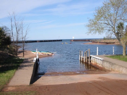
Big Bay Marina
Photo by Kevin Lehner